Map of Eastern Europe and Russia
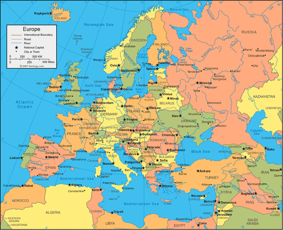
For the most part, Eastern Europe consists of plains. From the Pyrenees (not labeled on this map, but make up the line that stretches from the Bay of Biscay to the Mediterranean Sea, around Toulouse, France) to the Ural Mountains, one can have a successful agricultural career in these lands that stretch around 2,000 miles.
The Ural Mountains in Russia go from the Barents sea, around where the Pechora River is, to Kazakhstan, around where the Ural River is. They act as an edge to civilaztion mostly, as beyond them is the land of Siberia. They are also considered the natural barrier between Russia/ Europe and Asia. Therefore, most of Russia's cities exist in its western side.
The Volga River is the longest river is Europe, stretching from the Caspian Sea, almost to the Baltic Sea.
The Rhine River (unfortunately not labeled on this map) begins in Switzerland and flows into the North Sea from the Netherlands coast. It acts as an important trade route, and is the longest river in Germany.
The Alps in Austria, France, Germany, Italy, Liechtenstein, Slovenia and Switzerland are a huge tourist spot. Its total length is around 700 miles. (Unfortunately not labeled on this map)
The Scandinavian Peninsula is the largest Peninsula in Europe. Norway, the northern area of Finland, and Sweden make up its territory, and it is a good source of copper, iron and timber.
